Natural Communities
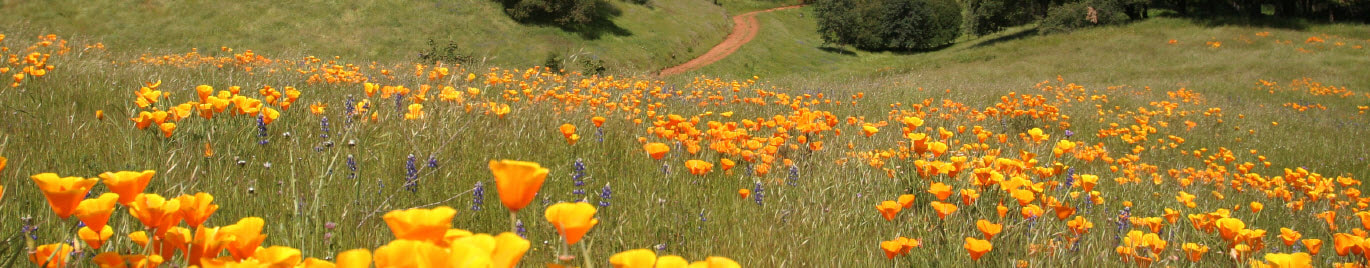
Grassland
The grassland community in the PCCP is defined as annual grassland and pasture land-cover types. Although vernal pool complex lands are also grasslands, they are treated as a separate defined community to focus on the conservation issues of covered vernal pool species. In western Placer County, annual grasslands occur naturally at the lower elevations below 300 feet asl. Annual grasslands in the Valley are dominated by non-native grasses and forbs, with few trees. Taken together, nearly half of the Valley landscape is in some form of annual grassland. In the Valley, there are still a few remnant examples of native grasslands, often found around the edges of wetlands or moist bottomlands. These are patchy with poorly defined boundaries and cannot be mapped from aerial photography.
The grassland community in the PCCP is defined as annual grassland and pasture land-cover types. Although vernal pool complex lands are also grasslands, they are treated as a separate defined community to focus on the conservation issues of covered vernal pool species. In western Placer County, annual grasslands occur naturally at the lower elevations below 300 feet asl. Annual grasslands in the Valley are dominated by non-native grasses and forbs, with few trees. Taken together, nearly half of the Valley landscape is in some form of annual grassland. In the Valley, there are still a few remnant examples of native grasslands, often found around the edges of wetlands or moist bottomlands. These are patchy with poorly defined boundaries and cannot be mapped from aerial photography.
Vernal Pool Complex
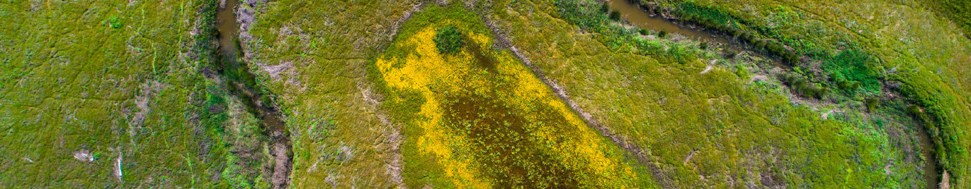
Vernal pools form in seasonally flooded depressions in annual grasslands under a combination of specific climatic, soil, hydrologic, and topographic conditions. The covered vernal pool branchiopods carry out their entire lifecycle in vernal pool wetlands, but the wetlands depend on the surrounding upland areas and together constitute the vernal pool complex. Because vernal pools form in grassland, the description of the grassland community applies here as well.
VERNAL POOL WETLAND
Vernal pools are seasonally inundated wetlands found in depressions that have a shallow impervious layer such as a clay pan or indurated hardpan (an aquatard). The aquatard layer perches water and prevents percolation so that water loss from vernal pools occurs only through evaporation and evapotransporation. Vernal pools are inhabited by a suite of specialized plants that are able to tolerate several months of inundation and anaerobic conditions, followed by months of hot, dry weather. Vernal pools are sometimes difficult to separate from other types of seasonal wetlands; hydrology and flora are used to make the distinction.
SEASONAL WETLAND IN VERNAL POOL COMPLEX
Seasonal wetland is a general term for seasonally saturated wetlands that are not defined as vernal pools or other specific wetland types. They are often depressional or bermed wetlands that have wetland hydrology lasting until early or mid-spring but become dry before emergent marsh species can become established. Seasonal wetlands often support the same species as wetland swales in addition to generalist species. Wetlands defined as seasonal wetlands in a vernal pool complex for the purpose of the HCP/NCCP are seasonal wetlands that occur within the vernal pool/grassland matrix but do not typically inundate for a long enough period to support typical vernal pool flora. They often consist of wetland features that were historically vernal pools but have been degraded as a result of past activities such as agricultural disking.
SEASONAL SWALES
Wetland swales are conveyance systems that occur on sloped topography. Water may flow during rainy periods in wetland swales, but not with enough intensity or duration to create the bed-and-bank morphology that defines riverine systems. Wetland swales are usually dominated by species that can occur in either wetlands or uplands. Upland swales lack extended soil saturation and have an upland flora that is not dominated by plant species dependent on wetlands or typical of vernal pools. Seasonal swales in a vernal pool complex are those that convey water within the vernal pool/grassland matrix.
Aquatic/wetland Complex
The aquatic/wetland complex community consists of aquatic vegetation and wildlife that is not primarily riverine or riparian (i.e., 5 percent of aquatic/wetland is attributed to the riverine-type constituent habitat) and not primarily associated with vernal pools. The aquatic/wetland complex community has strong wetland associations with aquatic/wetland habitat types. Therefore, most of the discussion of this community appears under constituent habitats. The aquatic/wetland complex natural community consists of delineated aquatic areas as described below and their associated uplands.
FRESH EMERGENT MARSH
In western Placer County, fresh emergent marsh occurs at a range of elevations throughout the Valley and the Foothills. Fresh emergent marsh is distinguished from deepwater aquatic habitats and wet meadows or grassland habitats by the presence of tall, perennial grass-like plants that are rooted in soils and permanently or seasonally flooded or inundated. The boundary between fresh emergent marsh and deepwater (i.e., lacustrine and riverine) habitats is roughly a depth of 6 feet. Fresh emergent marsh ecosystems can occur in basins or depressions at all elevations, aspects, and exposures, but they are most common on level to gently rolling topography.
LACUSTRINE
Lacustrine ecosystems are defined as inland natural ponds and lakes as well as artificial features such as stock ponds or small reservoirs. The relatively calm waters of lakes and ponds contrast sharply with those of riverine ecosystems. The oxygen content of lakes is relatively low compared to that of running water due to a combination of decomposition occurring at the bottom of lakes and the comparatively smaller quantity of water in direct contact with air. The gradations of oxygen, light, and temperature in lakes, along with currents and wave action (seiche), greatly influence the vertical distribution of lake and reservoir organisms.
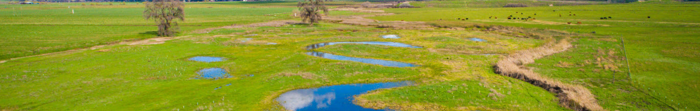
NON-VERNAL POOL SEASONAL WETLAND
Seasonal wetlands are defined as isolated wetlands and swales that pond water or have saturated soil during the rainy season. Seasonal wetlands are typically not found in well-defined depressions but occur in a variety of topographic situations, such as shallow basins in annual grassland or along ephemeral drainageways and swales. Seasonal wetlands occur throughout the Plan Area of western Placer County. Individual seasonal wetlands are typically small, and most occur within grazed annual grassland and irrigated pasture ecosystems. Some larger areas occur adjacent to fresh emergent marshes in agricultural settings in the western part of the Plan Area.
The aquatic/wetland complex community consists of aquatic vegetation and wildlife that is not primarily riverine or riparian (i.e., 5 percent of aquatic/wetland is attributed to the riverine-type constituent habitat) and not primarily associated with vernal pools. The aquatic/wetland complex community has strong wetland associations with aquatic/wetland habitat types. Therefore, most of the discussion of this community appears under constituent habitats. The aquatic/wetland complex natural community consists of delineated aquatic areas as described below and their associated uplands.
FRESH EMERGENT MARSH
In western Placer County, fresh emergent marsh occurs at a range of elevations throughout the Valley and the Foothills. Fresh emergent marsh is distinguished from deepwater aquatic habitats and wet meadows or grassland habitats by the presence of tall, perennial grass-like plants that are rooted in soils and permanently or seasonally flooded or inundated. The boundary between fresh emergent marsh and deepwater (i.e., lacustrine and riverine) habitats is roughly a depth of 6 feet. Fresh emergent marsh ecosystems can occur in basins or depressions at all elevations, aspects, and exposures, but they are most common on level to gently rolling topography.
LACUSTRINE
Lacustrine ecosystems are defined as inland natural ponds and lakes as well as artificial features such as stock ponds or small reservoirs. The relatively calm waters of lakes and ponds contrast sharply with those of riverine ecosystems. The oxygen content of lakes is relatively low compared to that of running water due to a combination of decomposition occurring at the bottom of lakes and the comparatively smaller quantity of water in direct contact with air. The gradations of oxygen, light, and temperature in lakes, along with currents and wave action (seiche), greatly influence the vertical distribution of lake and reservoir organisms.
NON-VERNAL POOL SEASONAL WETLAND
Seasonal wetlands are defined as isolated wetlands and swales that pond water or have saturated soil during the rainy season. Seasonal wetlands are typically not found in well-defined depressions but occur in a variety of topographic situations, such as shallow basins in annual grassland or along ephemeral drainageways and swales. Seasonal wetlands occur throughout the Plan Area of western Placer County. Individual seasonal wetlands are typically small, and most occur within grazed annual grassland and irrigated pasture ecosystems. Some larger areas occur adjacent to fresh emergent marshes in agricultural settings in the western part of the Plan Area.
Riverine/Riparian Complex
Riverine and associated riparian ecosystems are present in a diverse mosaic around the streams and rivers in the Plan Area. This mosaic is mapped as a single riverine/riparian complex land-cover type, which also defines the community. Other closely associated land-cover types and constituent habitats are interspersed within the riverine/riparian complex include grasslands, valley oak woodland, fresh emergent wetland, off-channel wetlands, and seasonal wetlands. The riverine aquatic habitat nominally represents the entire stream ecosystem for aquatic species including the covered salmonid fish.
RIVERINE
Riverine systems occurring in western Placer County include perennial, intermittent, and ephemeral streams. As the term implies, perennial streams sustain flows year-round. The larger streams in the Plan Area and vicinity such as the Bear River and American River are perennial. Intermittent streams receive some input from groundwater discharge in addition to precipitation runoff and seasonal flow. They typically do not flow in the late summer and fall. Ephemeral streams receive no input from groundwater and flow only during and following storm events in response to precipitation runoff. The flow regime in a stream profoundly affects its ecology, in particular its ability to support fish and other aquatic organisms.
RIPARIAN
These water-dependent ecosystems include widely distributed riparian habitats in western Placer County. Riparian ecosystems are recognized throughout California as important natural communities because of their limited extent compared to historical distributions, their importance to dependent plant and wildlife species, and the threats facing remaining stands. In western Placer County, riparian habitat woodland occurs on the American and Bear River corridors and along Coon Creek, lower Auburn Ravine, and lower Dry Creek. Significant stands are generally restricted to low-gradient depositional reaches with some floodplain development. Along most other creeks in western Placer County, this ecosystem occurs as narrow and generally discontinuous bands of trees, rarely occurs on intermittent streams, and never occurs on ephemeral streams that only flow during storm events.
Oak Woodland
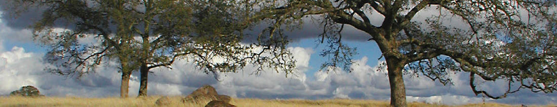
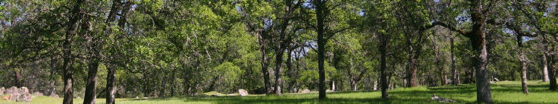
The oak woodland community occurs mainly in the Foothills and comprises a diversity of dominant tree species, which are represented by five woodland land-cover types: blue oak woodland, interior live oak woodland, mixed oak woodland, oak-foothill pine woodland, and oak savannah. Two non-woodland land cover types that have minor extent and are associated with woodland geographically are mapped with the oak woodland community. This includes foothill chaparral and rock outcrop. Because of its conservation importance, valley oak woodland is treated as a separate community.
The oak woodland community occurs mainly in the Foothills and comprises a diversity of dominant tree species, which are represented by five woodland land-cover types: blue oak woodland, interior live oak woodland, mixed oak woodland, oak-foothill pine woodland, and oak savannah. Two non-woodland land cover types that have minor extent and are associated with woodland geographically are mapped with the oak woodland community. This includes foothill chaparral and rock outcrop. Because of its conservation importance, valley oak woodland is treated as a separate community.
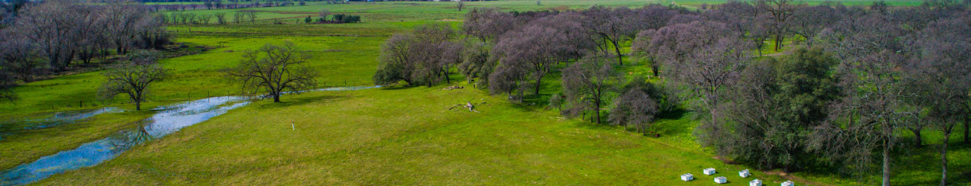
Valley Oak Woodland
Because of its conservation importance, valley oak woodland is treated as a separate community. It comprises one land-cover type. In many places, valley oak woodland could be mapped as riparian because it is associated with the Stream System. In the Plan, valley oak woodland and riparian woodlandriparian habitat are treated essentially the same for mitigation; therefore, the mapping distinction is immaterial. The Stream System association results in a small amount (0.2 percent) of riverine type habitat present in areas that have been mapped as valley oak woodland.
Because of its conservation importance, valley oak woodland is treated as a separate community. It comprises one land-cover type. In many places, valley oak woodland could be mapped as riparian because it is associated with the Stream System. In the Plan, valley oak woodland and riparian woodlandriparian habitat are treated essentially the same for mitigation; therefore, the mapping distinction is immaterial. The Stream System association results in a small amount (0.2 percent) of riverine type habitat present in areas that have been mapped as valley oak woodland.